1

 Reconnaissance Washington State Ride Sat Jun 03, 2023 1:00 pm
Two Wheels Better
Moderator

Once I stopped working the nine to six, Tuesday thru Saturday, that's been taking up my time lo these many years, I find myself staring at an actual physical roadmap laid out across the kitchen table. The idea I've got is to, at last, take the 'Big Block' on a four corner, Washington state ride. As I live on the 'wet side', in the central west of the state, and it's a bloody large area, relative to many of the other 49 states (18th largest of 50 @ 185,000 sq kms/71,000 sq miles) with which it shares a name, it requires some planning. I won't be riding from corner to corner round the edges, but will cover the map in an X pattern, the better to see more, plus the roads don't really cross the top from the NE to the NW corners due to wilderness and a certain 3286m/10,781' andesitic stratovolcano called Baker (Kulshan, or white sentinel).
The dry side is the larger area, mainly rural and agricultural, desert-like, with tall snow-covered mountains, crustic small towns, meandering rivers, industrial scale dams, orchards and wheat fields for miles. It is the classic American west without endless and dessicated desert terrain. Hell, you still even see a few cowboy hat-wearing pickup truck drivers raising two friendly fingers at you from atop the steering wheel as they pass by on a country road.
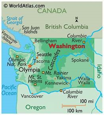
With that picture in mind, I set out to do a dry run over the Cascades to the near east. I rode the '06 K1200R so I could 'make some time'.

First stop, Mount Rainier (Tahoma, mother of waters) National Park, about 80 miles from my home.
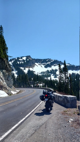
Working my way up to Chinook Pass, state route 410. The heavy winter snow is slowly melting, feeding the rivers, farms and communities below with silty, glacial freshness.
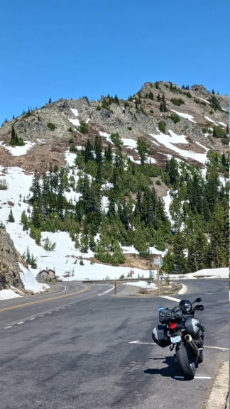
Just round the bend from Lake Tipsoo, the high point of highway 410, officially on the east side, with an elevation of approximately 1656m/5430'. I settled in behind a fast-moving queue of cars and campervans down to the town of Naches, near Yakima, for my first fuel stop. $4.89 per (US) gallon of premium. I managed 47mpg out of the often thirsty 165hp beast, when my usual best when commuting is 39mpg.
Heading up a lonely canyon to see if I could sort out a shortcut to Yakima Canyon, rather than going towards Yakima, then Selah, I found the roads! It had been at least five years since I'd passed that way with a group of riders from the local Beemer club and wasn't paying keen attention to the various turns the lead rider knew that day. The ride along the Yakima River is sublime. When I reached the end I turned round and re-rode it. Once thru the snaking river canyon with a beautiful ribbon of road beneath my wheels I decided to stop for lunch. Fitting the Americana theme I stopped at The Red Horse Diner in Ellensburg. Elvis and Marilyn were nowhere to be seen.
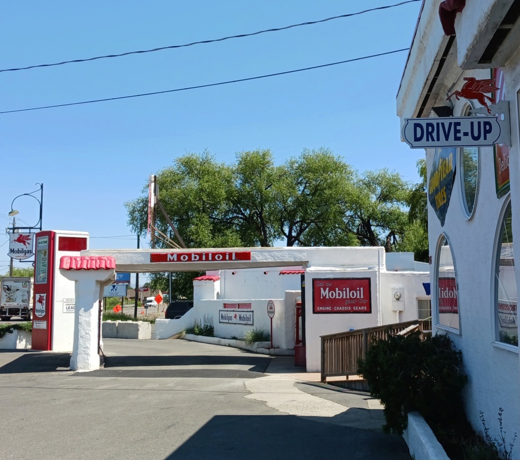
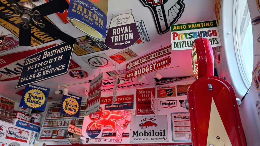
The soundtrack wasn't 1950s Bill Haley & the Comets, Elvis, Buddy Holly or Little Richard, but early '70s Who, Led Zeppelin, Deep Purple, Grateful Dead, Uriah Heep, Jethro Tull, Quicksilver Messenger Service & etc - the music of my younger youth. It made the spicy grilled chicken chipotle sammich with pepper jack cheese, tomato & lettuce, taste all the better. As the day was a warmish 80f/26.5c, I gulped three 'endles refill' non-sweetened iced teas to slake my thirst. The younger waitstaff might have had a hand in the rockin' music choice. I thanked the waitress for not playing Elvis, tho' I acknowledged to her the theme would've suited him better.
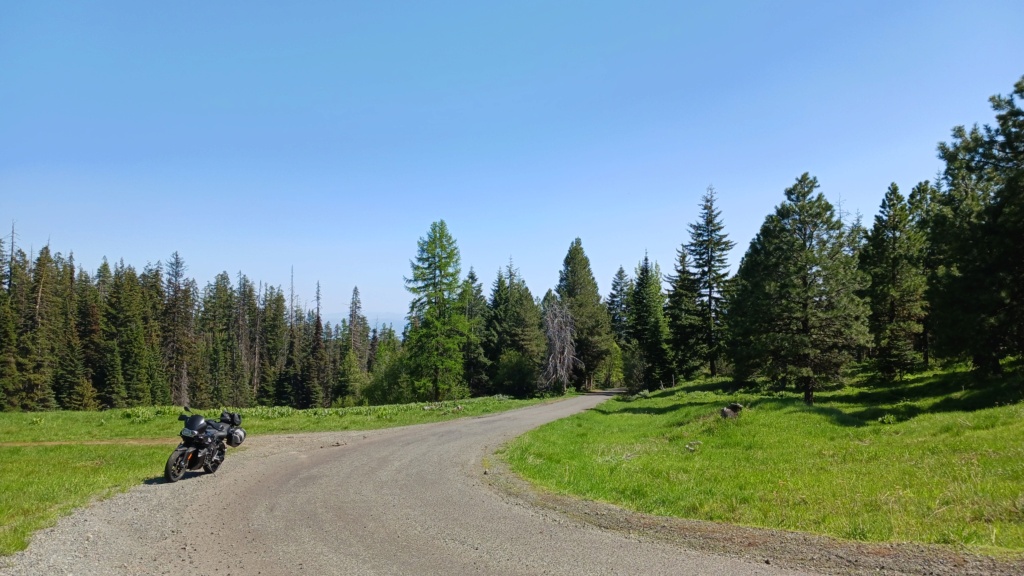
Time to explore some camping possibilities...heading north out of Ellensburg, I decided to see if I could wend my way over the low hills to state route 97. The road narrowed, eventually becoming a single lane, still sealed, 'til it topped out at the peak as gravel, with multiple choices to try. Fires had raized the forest, already precarious, but now almost completely wiped out at the top. I probably should've turned round when the road got rough, but who doesn't like to explore?!

At this altitude the pines are relatively low height, dense and scrubby. Plenty of places to roll up a dusty track a few hundred metres from the sealed road and find a flat spot beneath the trees. Water was springing abundantly from the ground in places, fueling a late spring, rapid growth of skunk cabbage, ferns and reeds.
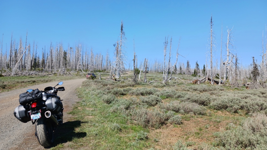
The urge to turn around wasn't as strong as the urge to see what was around the next bend. Here is the 'false summit'. The road surface was still smooth, with only a few large rocks. The arm-tiring ruts and berms would arrive later.
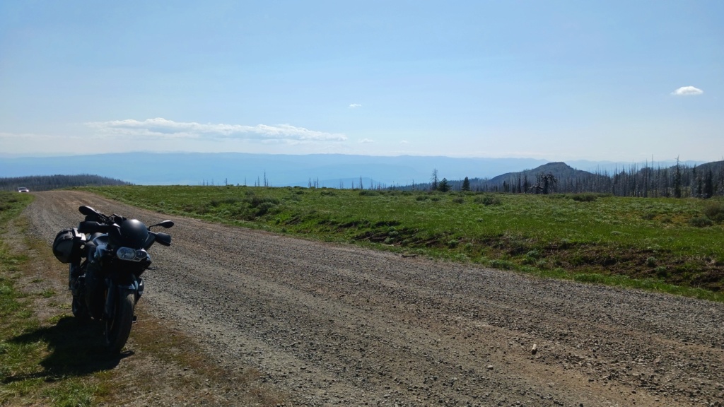
Where I had come from. A few 4WD vehilces were up there. I stopped to enquire of a thru road from a bloke who looked like he and his crew were surveying. Turns out a scoped rifle was parked on his tailgate and the tripods his buddies had several hundred metres away were not for viewing the terrain. "You might be able to get through. We came in from the south. We're just up here for shootin" was his response. I commented that this was an idle spot to blast away from. There was evidence of chainsaw activity with Forest Service signs suggesting a permit for firewood gathering. Blackened firepits were scattered about. I saw no litter. I reckon it'd be a sweet spot to stay overnight. Thanking him, I pressed on into the burnt and dried out timberline.
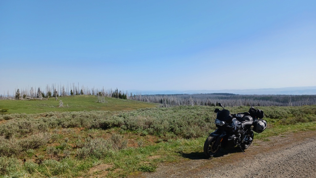
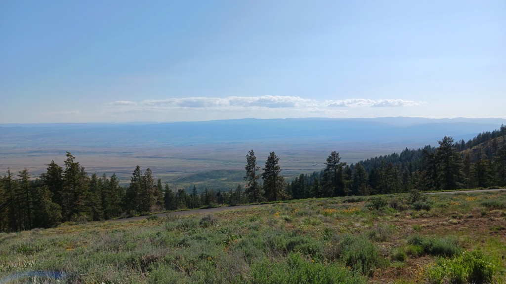
I managed to stumble upon the Lion's Head, and a mesa, appropriately called Table Mountain, but never got more than a few rough miles down the other side before I came upon impassable roads covered in dried, fallen timber. I imagine snowmobile could easily get through in the middle of winter when the white stuff covers these hills by several feet. 4WD cars and trucks could not pass, unless they had a chainsaw. Not too discouraged, I turned round three times when the road was stopped, and backtracked to head back down a bit into the green. The view from the top was endless, top of the world stuff. The K12R handled it all with aplomb. I reckon some more gritty tyres she'd climb like a mountain goat....err, maybe not. My arm and leg muscles and neck were stiff as I settled in for a sleep. Tomorrow's another day and there're more roads to survey.
The dry side is the larger area, mainly rural and agricultural, desert-like, with tall snow-covered mountains, crustic small towns, meandering rivers, industrial scale dams, orchards and wheat fields for miles. It is the classic American west without endless and dessicated desert terrain. Hell, you still even see a few cowboy hat-wearing pickup truck drivers raising two friendly fingers at you from atop the steering wheel as they pass by on a country road.

With that picture in mind, I set out to do a dry run over the Cascades to the near east. I rode the '06 K1200R so I could 'make some time'.

First stop, Mount Rainier (Tahoma, mother of waters) National Park, about 80 miles from my home.

Working my way up to Chinook Pass, state route 410. The heavy winter snow is slowly melting, feeding the rivers, farms and communities below with silty, glacial freshness.

Just round the bend from Lake Tipsoo, the high point of highway 410, officially on the east side, with an elevation of approximately 1656m/5430'. I settled in behind a fast-moving queue of cars and campervans down to the town of Naches, near Yakima, for my first fuel stop. $4.89 per (US) gallon of premium. I managed 47mpg out of the often thirsty 165hp beast, when my usual best when commuting is 39mpg.
Heading up a lonely canyon to see if I could sort out a shortcut to Yakima Canyon, rather than going towards Yakima, then Selah, I found the roads! It had been at least five years since I'd passed that way with a group of riders from the local Beemer club and wasn't paying keen attention to the various turns the lead rider knew that day. The ride along the Yakima River is sublime. When I reached the end I turned round and re-rode it. Once thru the snaking river canyon with a beautiful ribbon of road beneath my wheels I decided to stop for lunch. Fitting the Americana theme I stopped at The Red Horse Diner in Ellensburg. Elvis and Marilyn were nowhere to be seen.


The soundtrack wasn't 1950s Bill Haley & the Comets, Elvis, Buddy Holly or Little Richard, but early '70s Who, Led Zeppelin, Deep Purple, Grateful Dead, Uriah Heep, Jethro Tull, Quicksilver Messenger Service & etc - the music of my younger youth. It made the spicy grilled chicken chipotle sammich with pepper jack cheese, tomato & lettuce, taste all the better. As the day was a warmish 80f/26.5c, I gulped three 'endles refill' non-sweetened iced teas to slake my thirst. The younger waitstaff might have had a hand in the rockin' music choice. I thanked the waitress for not playing Elvis, tho' I acknowledged to her the theme would've suited him better.

Time to explore some camping possibilities...heading north out of Ellensburg, I decided to see if I could wend my way over the low hills to state route 97. The road narrowed, eventually becoming a single lane, still sealed, 'til it topped out at the peak as gravel, with multiple choices to try. Fires had raized the forest, already precarious, but now almost completely wiped out at the top. I probably should've turned round when the road got rough, but who doesn't like to explore?!

At this altitude the pines are relatively low height, dense and scrubby. Plenty of places to roll up a dusty track a few hundred metres from the sealed road and find a flat spot beneath the trees. Water was springing abundantly from the ground in places, fueling a late spring, rapid growth of skunk cabbage, ferns and reeds.

The urge to turn around wasn't as strong as the urge to see what was around the next bend. Here is the 'false summit'. The road surface was still smooth, with only a few large rocks. The arm-tiring ruts and berms would arrive later.

Where I had come from. A few 4WD vehilces were up there. I stopped to enquire of a thru road from a bloke who looked like he and his crew were surveying. Turns out a scoped rifle was parked on his tailgate and the tripods his buddies had several hundred metres away were not for viewing the terrain. "You might be able to get through. We came in from the south. We're just up here for shootin" was his response. I commented that this was an idle spot to blast away from. There was evidence of chainsaw activity with Forest Service signs suggesting a permit for firewood gathering. Blackened firepits were scattered about. I saw no litter. I reckon it'd be a sweet spot to stay overnight. Thanking him, I pressed on into the burnt and dried out timberline.

I managed to stumble upon the Lion's Head, and a mesa, appropriately called Table Mountain, but never got more than a few rough miles down the other side before I came upon impassable roads covered in dried, fallen timber. I imagine snowmobile could easily get through in the middle of winter when the white stuff covers these hills by several feet. 4WD cars and trucks could not pass, unless they had a chainsaw. Not too discouraged, I turned round three times when the road was stopped, and backtracked to head back down a bit into the green. The view from the top was endless, top of the world stuff. The K12R handled it all with aplomb. I reckon some more gritty tyres she'd climb like a mountain goat....err, maybe not. My arm and leg muscles and neck were stiff as I settled in for a sleep. Tomorrow's another day and there're more roads to survey.

__________________________________________________
"A long ride is the answer to a question you will soon forget!" ~ Anonymous
1977 R75/7-100, '93 K11/K12 Big Block, '93 K1100RS, '95 R100 Mystic, '96 K1100RS, 2 x '98 K1200RS, '06 K1200R & '09 K1300GT


