1

 Weekday Ride Over the Cascades to Eastern Washington & Back Thu May 16, 2024 6:08 pm
Two Wheels Better
Moderator

We have time. We have motorbike. Let's go explore a central Washington state canyon that's been written about plenty and which we've never visited. Pack a single pannier liner in case we stay out overnight somewhere. Be ready early. Tank full, tyres checked, GPS plugged in. The first day's destination is a little known place called Palisades, off two-lane state highway 28, out in the farm belt country of eastern Washington, between rural Quincy and Rock Island, WA, along the mighty Columbia River.
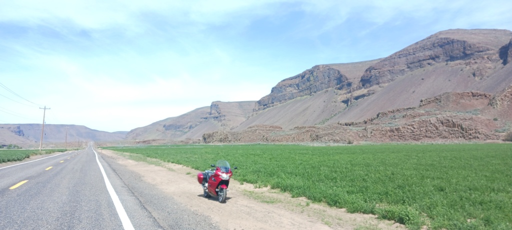
The "Palisades" got their name and their origin from being a watery pathway during that whopping bloody great big flood, 15 or 17,000 years ago, when glacial Lake Missoula burst its banks and flooded a path to the Pacific ocean a half a mile high, "they" say. Of course, this was well before gahd created the heavens and the earth, which we are told in Sunday school, was a mere 6,000 years ago. However inconveniently, the dinosaurs fit in somewhere back there in the mists of time, too.

It's pretty cool, with towering walls of basalt, itself a bit underwhelming once seen, especially after reading several articles about how remote and historical the place was described as.
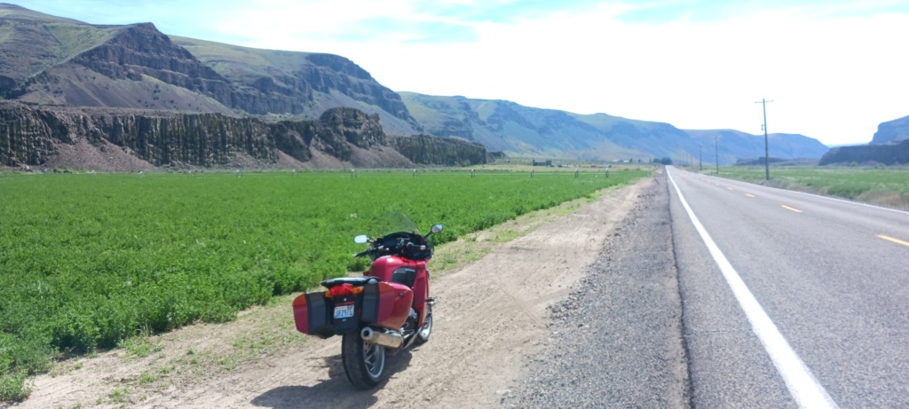
So we move on, to sort out a place to have a late lunch, and decide whether we wish to ride back home after an easy 260 mile day, done over six or seven hours by then.

A shady spot along the west side of the Columbia River above Rock Island had us in shade, and with time to think about stopping. We sorted a sweet little riverside motel within walking distance of cold beverages and pub grub. We stopped. Easy choice.

A Wheatie Boy and a Schofferhoffer hefe went down well, the second even easier. It was a busy place for a Tuesday evening in Wenatchee.
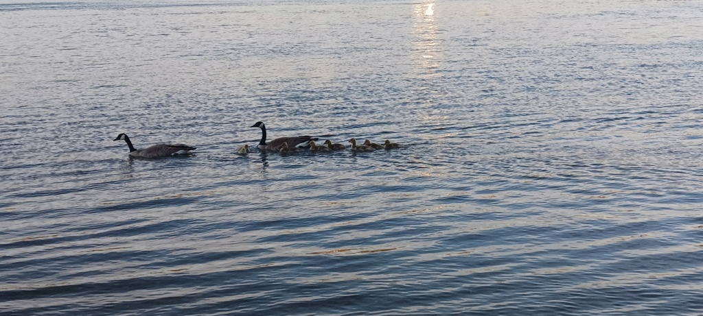
Mama & Papa goose watched their seven goslings very carefully as they paddled and fed near the riverbank.
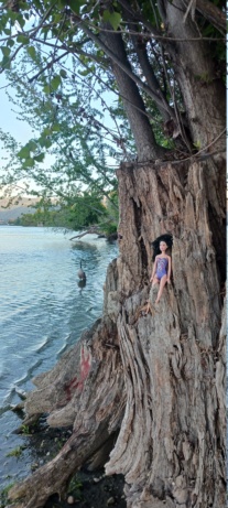
Barbie keeping an eye on proceedings.

At the confluence of the Methow and the Columbia, is a small farming (fruit) town of Pateros. It's here where we turn back west towards Twisp, Winthrop and Mazama. The winding road along the Methow River is faultless, curvaceous and can be taken at speed with nary a worry about the local constabulary. Speed camera worries? Who ever heard of such a thing in backwoods Washington state? The local sheriff's deputy in his all-black Ford Explorer raised his two fingers in a traditional steering wheel greeting as he passed us by going the other way at 75 mph. My tyres got a genuine workout, edge to edge.

The Methow River in the cowboy-cum tourist town of Winthrop, is a sweet li'l spot for a quick shady respite and slug of refreshing drinking water, before the climb up into the Cascades towards Rainy Pass.
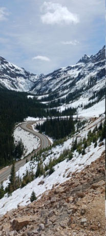
From 79 F (26 C) to under 50 F (10 C) in 45 minutes. Here we are at about 5,480 feet (1670 M) in altitude.

Rainy Pass/Mount Washington.

The essence.
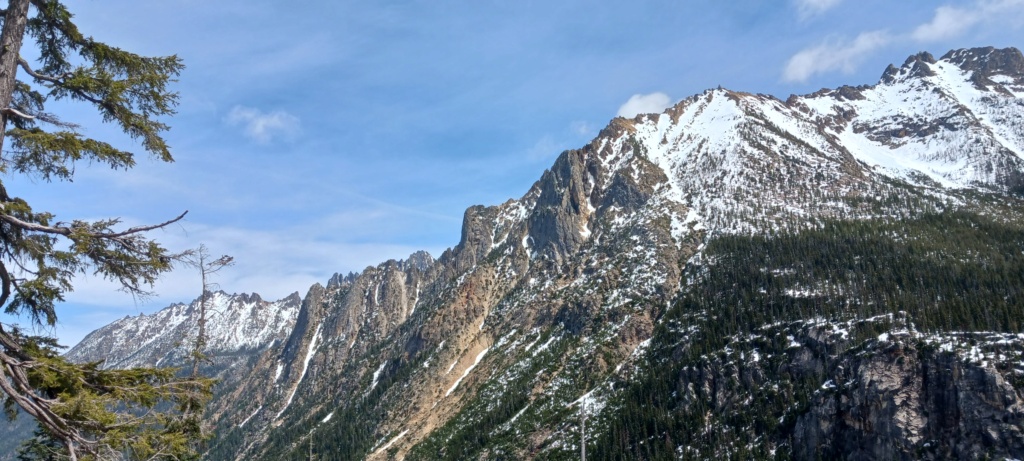
The North Cascades Highway, also known as WA State Highway 20, is usually closed from November through May, even June some years, It opened the last few days of April this year. The snowmelt is rapid, creating spontaneous cascades of water in the cliff faces at roadside. I counted twenty waterfalls that'll be dry in a month, as we rode along. Many areas heading down the west side had obvious signs of debris flows that can take out the road surface, but mainly just deposit mud, trees, sand and rocks across the roadway, leaving a mess for the highway crews to sort out.
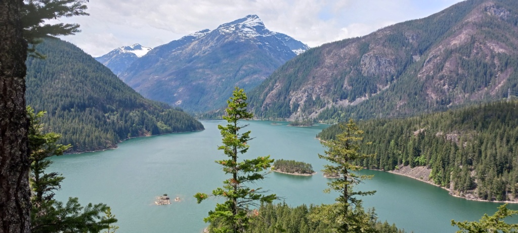
It wouldn't be a North Cascades ride without a quick stop to view Lake Diablo, a beautiful dammed lake/reservoir above a hydro plant near Newhalem, WA. Recent fires took out a large area of pristine woodland. It'll take yonks for it to return, if it does.

One of the last views of snow-covered mountains before we descend fully into the lush valleys below, and traffic, congestion and being tortured in stop and go traffic for an hour on I-5 in Seattle during late afternoon drive time.
An easy and relaxing, two day ride of about 700 miles. I slept well last night, but the maps are out already for the next one.

The "Palisades" got their name and their origin from being a watery pathway during that whopping bloody great big flood, 15 or 17,000 years ago, when glacial Lake Missoula burst its banks and flooded a path to the Pacific ocean a half a mile high, "they" say. Of course, this was well before gahd created the heavens and the earth, which we are told in Sunday school, was a mere 6,000 years ago. However inconveniently, the dinosaurs fit in somewhere back there in the mists of time, too.

It's pretty cool, with towering walls of basalt, itself a bit underwhelming once seen, especially after reading several articles about how remote and historical the place was described as.

So we move on, to sort out a place to have a late lunch, and decide whether we wish to ride back home after an easy 260 mile day, done over six or seven hours by then.

A shady spot along the west side of the Columbia River above Rock Island had us in shade, and with time to think about stopping. We sorted a sweet little riverside motel within walking distance of cold beverages and pub grub. We stopped. Easy choice.

A Wheatie Boy and a Schofferhoffer hefe went down well, the second even easier. It was a busy place for a Tuesday evening in Wenatchee.

Mama & Papa goose watched their seven goslings very carefully as they paddled and fed near the riverbank.

Barbie keeping an eye on proceedings.

At the confluence of the Methow and the Columbia, is a small farming (fruit) town of Pateros. It's here where we turn back west towards Twisp, Winthrop and Mazama. The winding road along the Methow River is faultless, curvaceous and can be taken at speed with nary a worry about the local constabulary. Speed camera worries? Who ever heard of such a thing in backwoods Washington state? The local sheriff's deputy in his all-black Ford Explorer raised his two fingers in a traditional steering wheel greeting as he passed us by going the other way at 75 mph. My tyres got a genuine workout, edge to edge.

The Methow River in the cowboy-cum tourist town of Winthrop, is a sweet li'l spot for a quick shady respite and slug of refreshing drinking water, before the climb up into the Cascades towards Rainy Pass.

From 79 F (26 C) to under 50 F (10 C) in 45 minutes. Here we are at about 5,480 feet (1670 M) in altitude.

Rainy Pass/Mount Washington.

The essence.

The North Cascades Highway, also known as WA State Highway 20, is usually closed from November through May, even June some years, It opened the last few days of April this year. The snowmelt is rapid, creating spontaneous cascades of water in the cliff faces at roadside. I counted twenty waterfalls that'll be dry in a month, as we rode along. Many areas heading down the west side had obvious signs of debris flows that can take out the road surface, but mainly just deposit mud, trees, sand and rocks across the roadway, leaving a mess for the highway crews to sort out.

It wouldn't be a North Cascades ride without a quick stop to view Lake Diablo, a beautiful dammed lake/reservoir above a hydro plant near Newhalem, WA. Recent fires took out a large area of pristine woodland. It'll take yonks for it to return, if it does.

One of the last views of snow-covered mountains before we descend fully into the lush valleys below, and traffic, congestion and being tortured in stop and go traffic for an hour on I-5 in Seattle during late afternoon drive time.
An easy and relaxing, two day ride of about 700 miles. I slept well last night, but the maps are out already for the next one.
__________________________________________________
"A long ride is the answer to a question you will soon forget!" ~ Anonymous
1977 R75/7-100, '93 K11/K12 Big Block, '93 K1100RS, '95 R100 Mystic, '96 K1100RS, 2 x '98 K1200RS, '06 K1200R & '09 K1300GT


