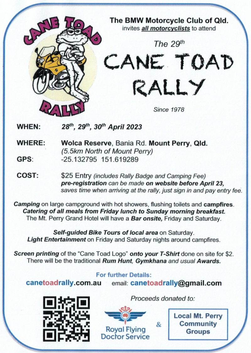
Well,
A bit delayed but thought I would do a write up for the rally for those of us that were not scared away by the rain.
Although invited to travel up on the Thursday by one of the organisers, I decided that Friday would be a better day to travel and eventually left home at midday. Some rain was predicted which eventually arrived as a few drops around Moore.
The usual route for me is via the Logan motorway, take the turn off to Toowoomba then up the Brisbane Valley Hwy through Fernvale and onto Esk. Turn onto the D'Aguilar Hwy and up through Nanago. Then it was a fuel stop at Goomeri and turning off for the short cut across the dirt before Gayndah to Mt. Perry. I was on the Dakar again which is turning out to be my preferred long distance traveller. Apart from the usual chain maintenance, I had to think twice about my tyres. They were probably to close to call as to being roadworthy but decided to go anyway.
All relatively uneventful until I came into Esk. Those of you familiar with the area will know the Esk-Hampton Road that approaches from the left onto the main street. It arrives past the golf course and is a 60km/hr speed limit and has a give way sign. As I approached I noticed a red BMW tintop that looked like a new 121 model. The car approached the intersection aggressively, enough so that I noticed it as a potential red flag.
Next thing I noticed the car in the mirrors and a few hundred metres up the road there is a turn off to the old railway station. Then, to quote the late Barry Sheene, it
took off like a rat up a drainpipe. Not turning right but overtaking myself and the two other vehicles I was following. Oh well, better off in front of me than behind. As the road heads out of town it veers right and I just saw the end of it as it disappeared from view.
Not to worry as I quite enjoy this part of the BV Hwy as it heads towards Toogoolawah and Harlin. So being on the moto I passed any of those vehicles that were slowing me down to arrive at the turn off to the D'Aguilar Hwy, planning to stop for fuel and a bite to eat at the independent Servo further up on the left.
There is a stop sign there, so as I quickly checked the traffic to the right and looking back I saw movement in the grass on the other side of the road. What is that? A dog or a kangaroo? No it was a fortiesh lady bending over and then I saw it; the red BMW with the front end stoved in after travelling through the T-intersection and taking out half the highway road sign. Oh, how I laughed! And thought about karma and natural justice. What an idiot. I can only assume she was speeding as she approached the intersection way too fast and cooked the brakes attempting to stop.
On a serious note, I thought, well at least she is up and about and appeared okay. Does she need any help? Who cares. She's an adult so she can sort herself out. Someone will eventually assist her.
So, I continued on and stopped at the Servo to refuel and grab a feed which is also is one of those Pie Face places, so good motorcycle travelling food. I'm starting to make this place a regular stop as nearby there is a small park with the Colinton war memorial enclosed and usually no one else about.
Continuing on through the usual places of Moore and the Blackbutt Range twisty bit, Yarraman, Nanango and stopping at Goomeri. I refuelled here just in case there were any problems at Mt. Perry on the way out to enable a sufficient reserve. Just as well I did because little did I know that we were to encounter Matt's attempts at navigating on a straight road on Sunday.
As I had departed later than expected, I decided to take the shorter route via Mingo Crossing across the dirt instead of the long way round via Eidsvold. A significant time saver and a scenic route. Just follow the signs and pass the pleasant and popular camping spot on the river at Mingo. Two main stretches of dirt with a small one in the middle. As per Gary's advice the road had been graded three weeks previously but it would appear on the southern section only. Only once on the northern bit did I have both wheels of the Dakar wanting to go in opposite directions to travel.
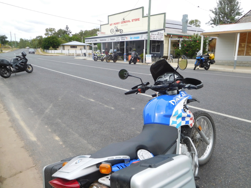
Arriving in Mt.Perry I stopped at the store then noticed familiar faces at the pub where I stopped briefly. A quick hello to some of the organisers and a promise by me to be back after setting up my tent for a meal. Well I set up next to Rick at the site and the hours of darkness ensured the tent erection took longer than usual. And somehow decided not to return to the pub after all. Apparently someone held me to my word and nearly starved waiting for me.
The site itself was full of bikes and tents and according to one of the organisers they had 250 arrivals on Friday alone. And they were still arriving during the gymkhana the next day. So it was quite well attended and at one stage I thought we were at AgFest by the amount of noisy tractors there. There were quite a few familiar faces, especially amongst the BMW Club members. I was also a newly (re)joined member of the club after being shanghaied by a member of this forum! At least they gave me my old number back.
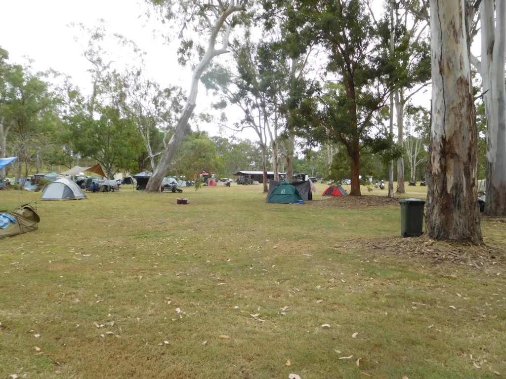
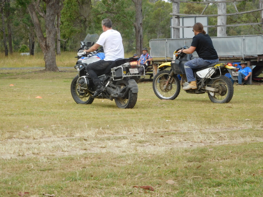
Saturday dawned and the caterers were quite strict in closing the bar off at 10:00pm and with the noise ceasing a good nights sleep was possible. I went into town for lunch and returning found Matt had arrived and pitched next to Rick and I. The gymkhana was held and naturally involved events with motorcycles. As entertaining as they were, I am surprised there were no injuries. Perhaps the local but subdued police attendance ensured that. There was no way we would compete for largest club attendance with only five forum members present so assume it was the BMW club winning. No idea who won the Rum Hunt.
Matt and I went into town for a meal at the pub where a handful of people had decided to stay. Good for them as it rained whilst there. After chatting with friends we departed in darkness along a slow and wet road. Sitting around our non-existent campfire we chatted and eventually retired. During the night some there was a bit of wind running through the trees and fortunately no deadfall on any of us. Then the rain came and it was heavy. Glad it was at night but that meant wet tents when packing up.
Up early and after brekky and packing we departed as a trio under the guidance of Matt. We decided to refuel at Mundubbera and then ride the river road, via the lookout and into Gayndah the back way. Now the other two had travelled this way into Mt. Perry whilst I cut across the dirt, so I was a little unfamiliar with this part of the road.
So, Matt led the way and I followed behind. Past the turn off to Gayndah which some were taking and others not. No big deal or so I though. After travelling about fifteen minutes we came to some roadworks and Matt stopped. Whoops. Looks like we turned north to Cairns instead of south to Brisbane on a major road even though he had travelled that way the day before. A slight questioning of one's ancestry slipped a cross my mind.
A u-turn and on our way again and taking the correct turn off we headed into Eidsvold to refuel along with a few others. Better to refill now than later. It should be fairly straightforward to get to Mundubera if we follow the highway. It was and we turned off and were led on a merry little goose chase trying to find the river road. Matt had suggested that he show us the lookout along the river road and an old railway bridge. Sounds good.
Then we found the river and crossed the river. Now to my way of thinking when I read a map and it shows the river road running south of and parallel to the river, then it should be pretty bloody obvious where the road is. The road here was heading south and a turn off to the left was completely ignored by our
tourenfuhrer. In fact the road was as straight as an arrow heading south with a big sign indicating Dalby and Chinchilla around 170km away. So as Matt hammered away on his RS up the hill I pulled over and Rick and I discussed the route options. I was in a bit of a hurry to get away as I had arranged to catch up with a former work colleague in Wondai and did not wish to be late. So after five minutes Rick gave chase in case Matt was waiting for us.
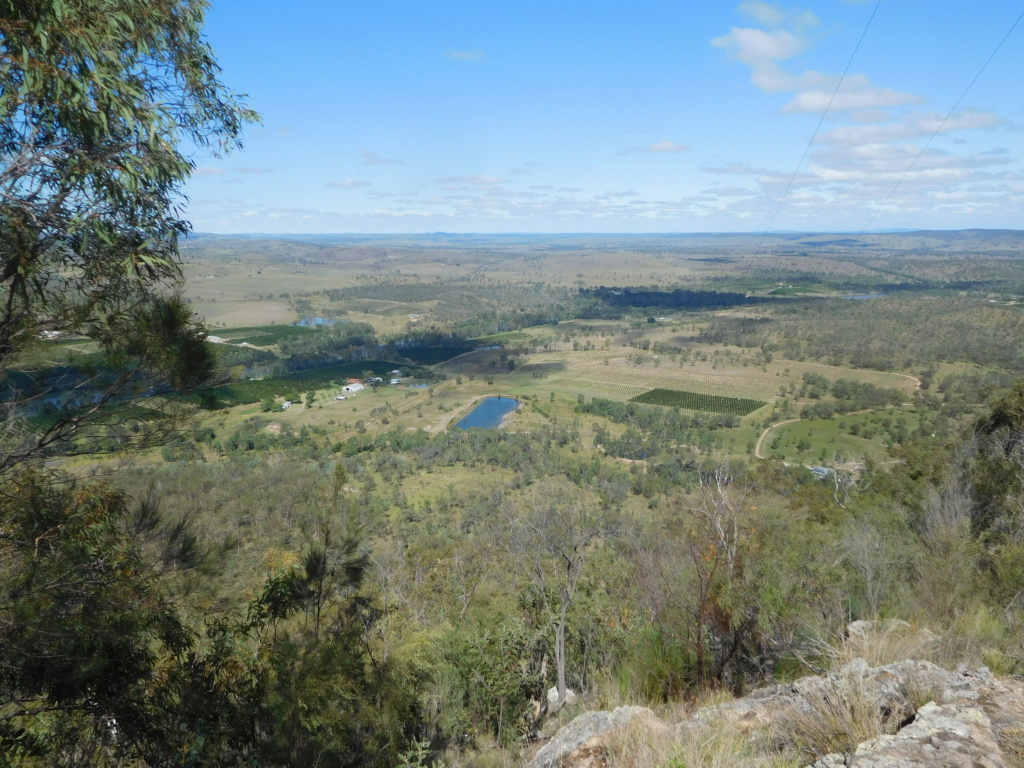
Turning around I found the correct turn off which was a pleasant enough ride and turned off for the lookout which entailed crossing the Burnett River. A little tight and twisty at times with a mix of dirt and bitumen until I arrived at McConnell Park lookout. An impressive view for the area. There was a low flying helicopter below us and I wondered if they were looking for Matt because I had no idea where he was. I caught a glance of Rick crossing the river below and he phoned, arriving just before I left.
I took my leave and eventually arrived in Wondai where I caught up with a mate whom I had worked with prior to retiring. He was now living in this area with his family and we chatted in a little country diner for two hours before I decided to return home before it became too dark.
Now I knew it was a fairly straightforward trek along the same roads that I had arrived on, so no chance of taking the wrong road for me. I headed off through Kingaroy where my mate advised not to stop for fuel as it was always more expensive there than the surrounding towns.
Well, not that it mattered by now but I had had to question Matt's ancestry along the way as I could not conceive how any one could have made such basic errors in navigating. However Grumpy being such the pleasant soul he is, I could not see that being the source of the problem. Perhaps other members of the family? Then it hit me. Matt had been in the Army. Now everyone in the military learns basic map reading as part of their training but surely even after Bill's GPS failures during the Walwa Run, this trip should be a run in the park. Army training? Aha! There is no doubt that Matt was a Commissioned Officer and never told us.
I did send him a text when I arrived home and asked how Dalby was? Or was it Chinchilla? But he never did reply.....


 Kane Toad Rally for K Owners Sat Jan 14, 2023 3:55 am


