1

 Columbia River Gorge & the Three (make that four) Volcano Blast Fri Aug 31, 2018 4:17 pm
Two Wheels Better
Moderator

Time on my hands. A capable motorbike. A clear break in the forecast.
That's trinity enough for me.
Wednesday morning I headed out on a bright, clear morning, with the idea of riding as many two lane roads of western Washington/Oregon as possible. I hoped to avoid the Interstate 5 drone. While most effective at conveying a rider no short distance in no time at all in something nearing boredom, as it is. The idea was to spend a coupla days riding and camping out and around the area's three major volcanoes, 14,441 foot-tall Mt Rainier, the infamous 8,363 feet of Mt St Helens (just under 2,000' came off the top with the May '80 eruption), and the quiet giant, all 12,280' of remote Mt Adams. I also passed the 11,250' Mt Hood, on the Oregon side.

The salmon are running to their spawning grounds, and the anglers are after them. Here we are in Castle Rock, Washington, along the Cowlitz River.

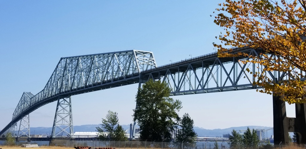
Crossing the Mighty Columbia between Longview, WA and Rainier, OR requires a ride over this monster, and what a view from the top. The trees are beginning their slow colour descent into Autumn.

Portland, Oregon has plenty of fine motorbike roads, and I lived there in the early '00 for several years, so I thought I'd retrace some of my favourites. Here is a view of the top end of the Willamette valley from Skyline Drive, just east of Cornelius Pass. A small amount of lingering smoke haze from the region's wildfires is still visible. Like most places, the traffic has increased to an almost unbearable level. I vow never to ride Cornelius Pass during a weekday. The massive trucks and queue of cars on the tight curves had us all at a walking pace.

Portland's Forest Park, the largest city park in North America within a city's limits. It beats Vancouver's Stanley Park and New York's Central Park in acreage, and a good bit of it is deep, dark, ferny forest. I'm gunna beep my horn in that tunnel, and the next and the next. It's almost a requirement.

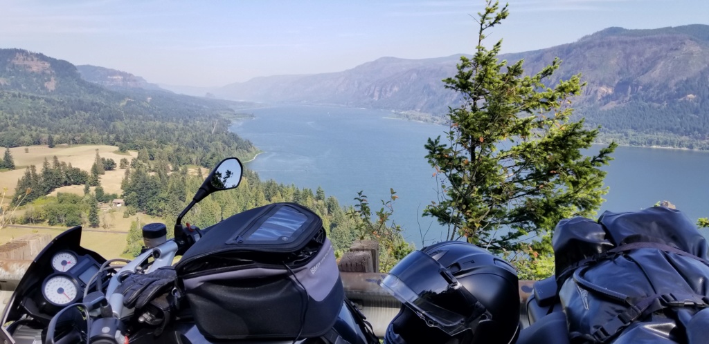
Cape Horn lookout of the Columbia river gorge from WA state highway 14, a twisting ribbon of road that at times is high above the Gorge, then next mere feet from the water, passing Basalt columns like Beacon Rock, windswept rockslides, former Indian fishing falls, whispery waterfalls and pine forests.

The Bonneville Dam, along with several other large dams, provides clean hydro power while also providing a fish ladder for the large number of salmon and other fishies. Unfortunately, since the '30s, the locals, with limited say in the progress of man, no longer have full and ready access to their traditional fishing falls, many of which are inundated, along with their villages and petroglyphs. Still, this time of the year they are out their catching the copious salmon that swim back upstream to spawn. One can buy fresh and smoked salmon from them along highway 14.

After a 300+ mile first day, a coldie and grub at the local brewpub in Stevenson, WA, and a 17 mile twisty ride up into the heart of the Gifford Pinchot Wilderness, I settled into my camping spot. Not one other camper was there. The night was warm and silent save the cool bubbling creek and occasional whisps of breeze in the tall pines above. I slept like magic.

Next Day, 7am, along the tracks and highway 14 near the confluence of the Little White Salmon river and the Columbia, looking west. The rest of the day would clear, with a light breeze, and top out at nearly 29c (about 85f). But for now, it's zippers closed, heated grips on, let's find some brekky. I was not disappointed.

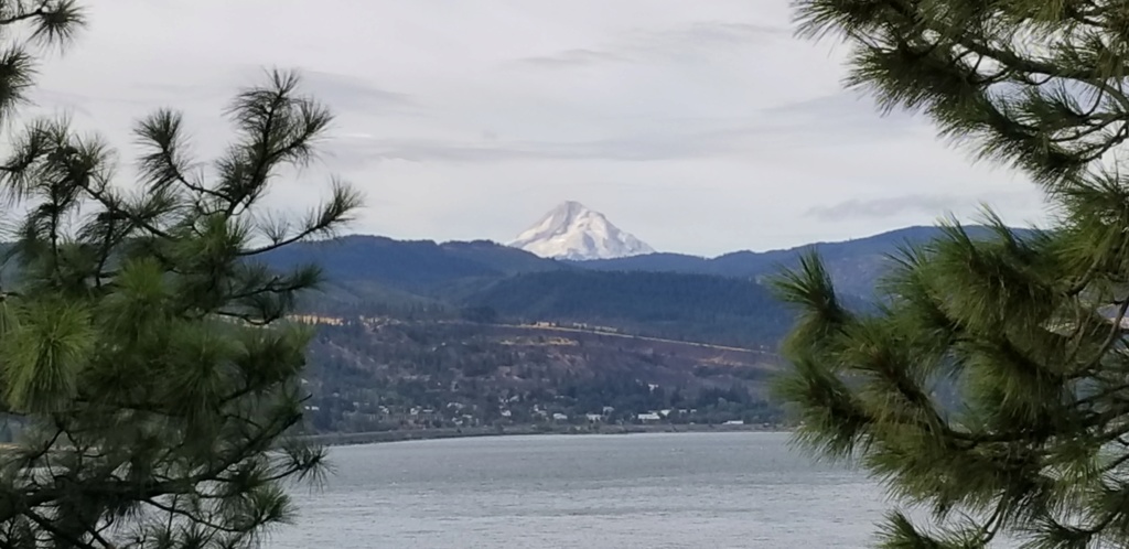
Not the money shot, but worth a look. Snow-covered Mount Hood, on the Oregon side, from a lookout on highway 14.

This is my view from the North Shore Cafe in White Salmon, Washington, a place I recommend for travellers. The food and beverages were mighty fine after a night in the forest. I had switched off my kill-switch to stop the motor but left the key in the on position, only to come out an hour later to a nearly flat battery. A third gear bump start downhill from the town had me purring again and the battery stay afloat the remainder of the trip. A Doh! moment, for certain, but the place is like that. Leave your helmet and keys on the bike with no worries.

Little used old Highway No 8 parallels highway 14, but is as fast and MUCH more twisty. I re-ran a couple of the sets of curves just because those Conti Sport Attack radials just seem to stick like glue!

All the while there's this view over a rider's shoulder...

Route 142 from Lyle, WA through to Goldendale, WA is a road I used to ride every coupla weekends when I lived near Portlandia. It's been eleven or twelve years since I wore a tyre on its surface. The roads bends and curves alongside the Klickitat river with plenty of scrub oak, short pines, craggy, rocky basalt outcroppings and straw-coloured, dried out grasses from the Summer drought. Views of the fishermen waist deep in the silty, glacial runoff water was a sight to behold. Just before leaving the valley and heading up onto the high plains, the road twists and turns with 15mph bends and plenty of wide sweepers, ideally suited for a 160+hp Duolever-equipped muscle bike. I was elated inside my helmet and promised the grinning evil and the smiling angel on my shoulders that I'd go back often - I had this road to myownbadself the entire way!

This poor bugger, Mt Adams, doesn't get much press as compared to her cousins, Mt Rainier and Mt St Helens, but rest assured she's an active volcano that has erupted relatively recently, geologically speaking (550 BC).

Roads and views to live for.

Highway 142 near the Little Klickitat river.

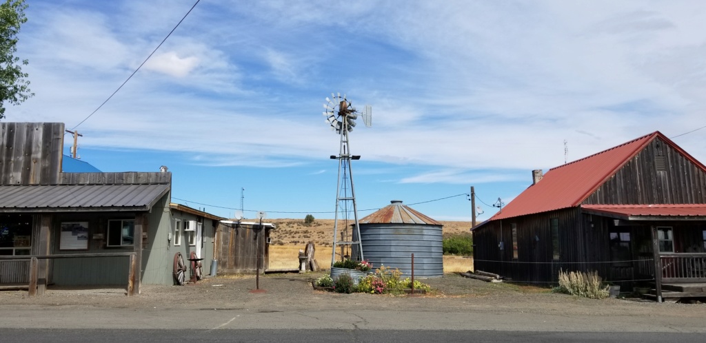
Bickleton, Washington is a quiet little place with a town hall, post office, restaurant, bar and a few houses. The locals drive muddy pickups with a dog on the back, and when ordering salad with dinner wouldn't dream of getting the dressing on the side like no city folk.

Descending to the town of Mabton from Horse Heaven Hills, into eastern Washington's breadbasket, the Yakima river valley, a place of cattle, fruit orchards and hop vines, ranches, vineyards and trailer parks. A working knowledge of Spanish is a plus, and if you want chiles rellenos autentica, I know the place!

As is often the case, once you reach the upper edge of the Cascade mountain range, the weather shifts from the dry of the east to the wet of the west, and I know I'm nearly home. This is the view just below Chinook Pass, above Cayuse Pass, looking southward.
All in all it was a two day, 700 mile reconnaissance ride with fine weather, excellent roads, and with many interesting people met along the way. All up, four tanks of premium fuel (two of which without ethanol), two restaurant meals and a coupla smooth frothies, tea made in my campsite, lunch snacks packed into the tankbag, one single roadmap, a change of clothes, a small tent and sleeping bag, and memories made.
That's trinity enough for me.
Wednesday morning I headed out on a bright, clear morning, with the idea of riding as many two lane roads of western Washington/Oregon as possible. I hoped to avoid the Interstate 5 drone. While most effective at conveying a rider no short distance in no time at all in something nearing boredom, as it is. The idea was to spend a coupla days riding and camping out and around the area's three major volcanoes, 14,441 foot-tall Mt Rainier, the infamous 8,363 feet of Mt St Helens (just under 2,000' came off the top with the May '80 eruption), and the quiet giant, all 12,280' of remote Mt Adams. I also passed the 11,250' Mt Hood, on the Oregon side.

The salmon are running to their spawning grounds, and the anglers are after them. Here we are in Castle Rock, Washington, along the Cowlitz River.

Crossing the Mighty Columbia between Longview, WA and Rainier, OR requires a ride over this monster, and what a view from the top. The trees are beginning their slow colour descent into Autumn.

Portland, Oregon has plenty of fine motorbike roads, and I lived there in the early '00 for several years, so I thought I'd retrace some of my favourites. Here is a view of the top end of the Willamette valley from Skyline Drive, just east of Cornelius Pass. A small amount of lingering smoke haze from the region's wildfires is still visible. Like most places, the traffic has increased to an almost unbearable level. I vow never to ride Cornelius Pass during a weekday. The massive trucks and queue of cars on the tight curves had us all at a walking pace.

Portland's Forest Park, the largest city park in North America within a city's limits. It beats Vancouver's Stanley Park and New York's Central Park in acreage, and a good bit of it is deep, dark, ferny forest. I'm gunna beep my horn in that tunnel, and the next and the next. It's almost a requirement.

Cape Horn lookout of the Columbia river gorge from WA state highway 14, a twisting ribbon of road that at times is high above the Gorge, then next mere feet from the water, passing Basalt columns like Beacon Rock, windswept rockslides, former Indian fishing falls, whispery waterfalls and pine forests.

The Bonneville Dam, along with several other large dams, provides clean hydro power while also providing a fish ladder for the large number of salmon and other fishies. Unfortunately, since the '30s, the locals, with limited say in the progress of man, no longer have full and ready access to their traditional fishing falls, many of which are inundated, along with their villages and petroglyphs. Still, this time of the year they are out their catching the copious salmon that swim back upstream to spawn. One can buy fresh and smoked salmon from them along highway 14.

After a 300+ mile first day, a coldie and grub at the local brewpub in Stevenson, WA, and a 17 mile twisty ride up into the heart of the Gifford Pinchot Wilderness, I settled into my camping spot. Not one other camper was there. The night was warm and silent save the cool bubbling creek and occasional whisps of breeze in the tall pines above. I slept like magic.

Next Day, 7am, along the tracks and highway 14 near the confluence of the Little White Salmon river and the Columbia, looking west. The rest of the day would clear, with a light breeze, and top out at nearly 29c (about 85f). But for now, it's zippers closed, heated grips on, let's find some brekky. I was not disappointed.

Not the money shot, but worth a look. Snow-covered Mount Hood, on the Oregon side, from a lookout on highway 14.

This is my view from the North Shore Cafe in White Salmon, Washington, a place I recommend for travellers. The food and beverages were mighty fine after a night in the forest. I had switched off my kill-switch to stop the motor but left the key in the on position, only to come out an hour later to a nearly flat battery. A third gear bump start downhill from the town had me purring again and the battery stay afloat the remainder of the trip. A Doh! moment, for certain, but the place is like that. Leave your helmet and keys on the bike with no worries.

Little used old Highway No 8 parallels highway 14, but is as fast and MUCH more twisty. I re-ran a couple of the sets of curves just because those Conti Sport Attack radials just seem to stick like glue!

All the while there's this view over a rider's shoulder...

Route 142 from Lyle, WA through to Goldendale, WA is a road I used to ride every coupla weekends when I lived near Portlandia. It's been eleven or twelve years since I wore a tyre on its surface. The roads bends and curves alongside the Klickitat river with plenty of scrub oak, short pines, craggy, rocky basalt outcroppings and straw-coloured, dried out grasses from the Summer drought. Views of the fishermen waist deep in the silty, glacial runoff water was a sight to behold. Just before leaving the valley and heading up onto the high plains, the road twists and turns with 15mph bends and plenty of wide sweepers, ideally suited for a 160+hp Duolever-equipped muscle bike. I was elated inside my helmet and promised the grinning evil and the smiling angel on my shoulders that I'd go back often - I had this road to myownbadself the entire way!

This poor bugger, Mt Adams, doesn't get much press as compared to her cousins, Mt Rainier and Mt St Helens, but rest assured she's an active volcano that has erupted relatively recently, geologically speaking (550 BC).

Roads and views to live for.

Highway 142 near the Little Klickitat river.

Bickleton, Washington is a quiet little place with a town hall, post office, restaurant, bar and a few houses. The locals drive muddy pickups with a dog on the back, and when ordering salad with dinner wouldn't dream of getting the dressing on the side like no city folk.

Descending to the town of Mabton from Horse Heaven Hills, into eastern Washington's breadbasket, the Yakima river valley, a place of cattle, fruit orchards and hop vines, ranches, vineyards and trailer parks. A working knowledge of Spanish is a plus, and if you want chiles rellenos autentica, I know the place!

As is often the case, once you reach the upper edge of the Cascade mountain range, the weather shifts from the dry of the east to the wet of the west, and I know I'm nearly home. This is the view just below Chinook Pass, above Cayuse Pass, looking southward.
All in all it was a two day, 700 mile reconnaissance ride with fine weather, excellent roads, and with many interesting people met along the way. All up, four tanks of premium fuel (two of which without ethanol), two restaurant meals and a coupla smooth frothies, tea made in my campsite, lunch snacks packed into the tankbag, one single roadmap, a change of clothes, a small tent and sleeping bag, and memories made.
__________________________________________________
"How many cars did we pass today?" "ALL of them."
1977 R75/7-100, '93 K11/K12 Big Block, '93 K1100RS, '95 R100 Mystic, '96 K1100RS, 2 x '98 K1200RS, '06 K1200R & '09 K1300GT


